 |
|
|
|
|
| Map Gallery Slide Show | Image 24 of 75 | Satellite Coverage Map |
 |
||
| Unclassified Military Satellite Coverage Map | ||
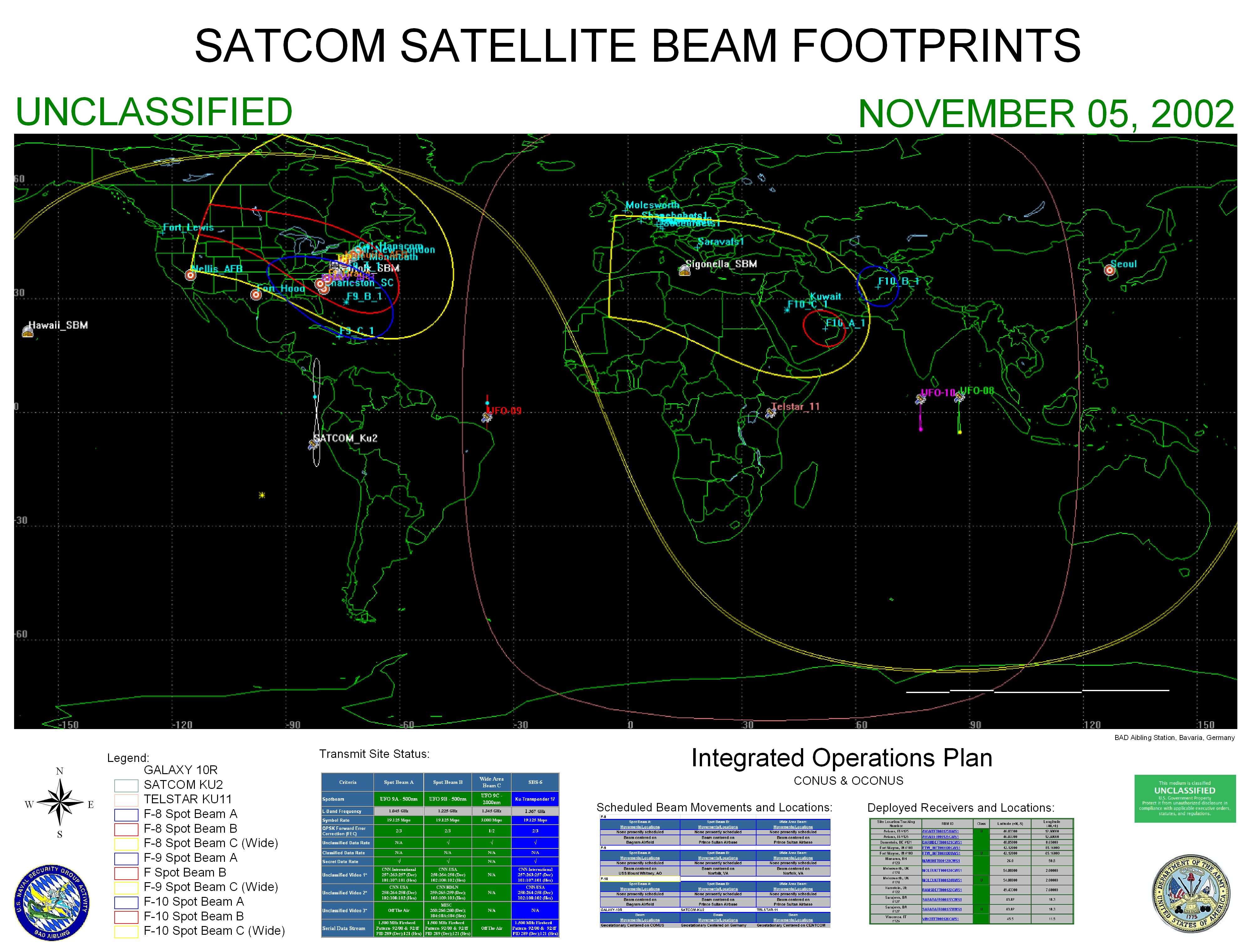
An example of satellite "spot beam" footprints with a reception area of Northern Command (USNORTHCOM) and Central Command (CENTCOM). This coverage is for US Air Force satellites F8, F9, F10 and SATCOM KU2 as well as leased commercial satellites Galaxy 10 and Telstar 11. These satellites were used to transmit Video, Television and Internet data to remote locations and ships that otherwise would not have that capability. These maps were created for planning purposes as well as operations. The ellipses/horseshoes indicate the location where reception is available and the necessary antenna diameter for receiving data. When searching for a satellite, it's very important to know if the beam reaches your location. The footprint of a communications satellite is the ground area that its transponders offer coverage, and determines the satellite dish diameter required to receive each transponder's signal. There is usually a different map for each transponder (or group of transponders), as each may be aimed to cover different areas. Footprint maps usually show either the estimated minimum satellite dish diameter required or the signal strength in each area measured in dBW. |
||
| CLICK HERE TO DOWNLOAD | ||
| < back | up ^ | next > |